I don’t know if this would even be something that could be implemented, but here it goes.
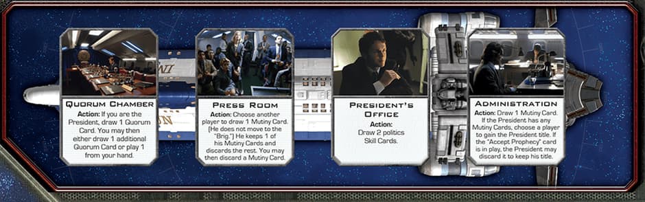
I know in 99% of games, locations never change where they are physically located on the board. However, BSG falls into that weird 1% with it’s last expansion. There is an board overlay that sites on Colonial One, adding a fourth space to go along with the three that were already there, and shifting the three to the left so they are all spaced evenly within the same size rectangle. There are quite a few send to location traits as well as report traits that use the zone name & coordinates to determine visually where to send something, and what to report.
The module is currently set up so the base game and all three “expansions” are in the .VMOD, and it uses Global Properties that are set by the players when the game is first loaded to determine with expansion items to load and which to leave out. Is there a way to add in way to set Zones/Region coordinates and names based on those same global properties. That way, the names will be displayed properly based on if the overlay is there or not, and the send to location traits will send things to the correct spot. I’m going to include screenshot of the area in question with the original three spaces showing, and another one showing the four space overlay placed over it, so you can see how the locations physically move right, so their X coordinates will change if the overlay is in use.