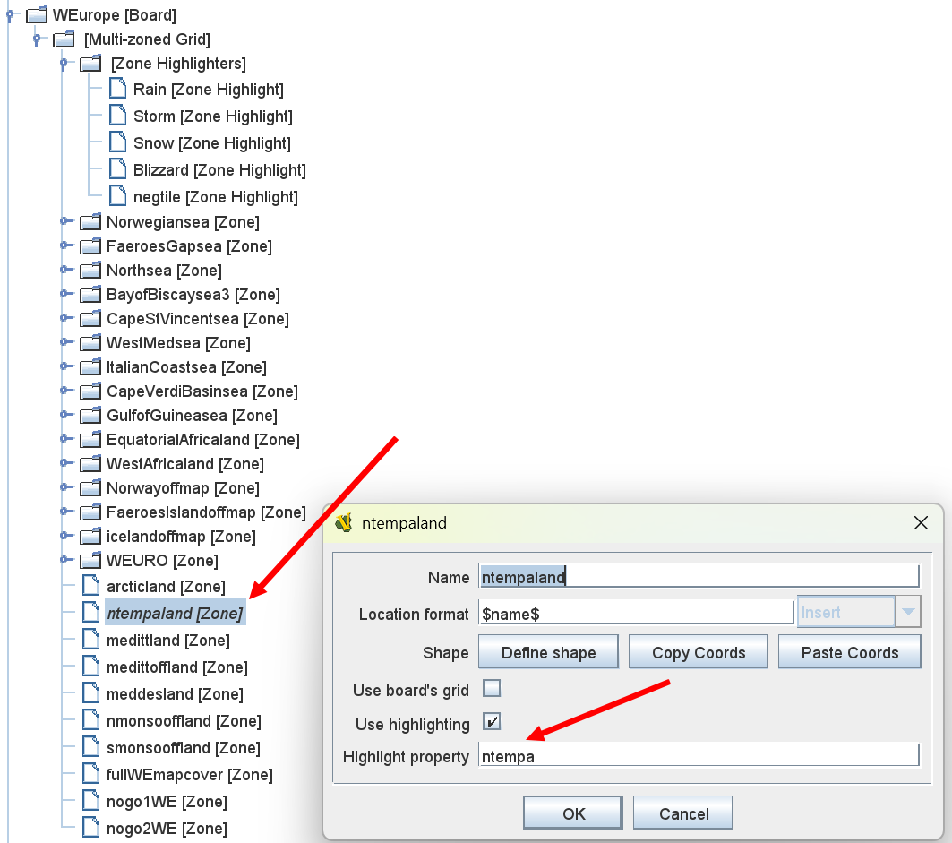
I use a number of zones for the maps used in the game. The group below WEURO zone are for indicating what a weather zone is currently experiencing (the weather - fine, rain, snow, storm or blizzard). The WEURO zone defines the overall map and sets the hex grid ‘overlay’. The zones above WEURO zone are used to delineate the various sea zone boxes in the various seas and establish a separate grid pattern for game pieces to snap to.
When I use ‘$CurrentZone$’, I get WEURO. Use ‘$LocationName$’ I get WEURO and the hex grid number.
What I really want to get is the current weather zone (name of a zone under/below the WEURO zone), so I can then access the highlight name property and its current value.
I appreciate that this may not be possible, but there are far more user savvy people than me out there that may provide some help.
Anyhow, here’s hoping.
I did not understand what you are doing with the weather zones. Are the weather zones subdivisions of the bigger WEURO? Can the same weather zone have different kinds of weather? If yes, why not use a global variable?
There are 6 weather zones. Arctic, NTH Temperate, Mediterranean, NTH Monsoon, STH Monsoon and STH Temperate. Each zone may experience different weather types (fine, rain, storm, snow or blizzard). Zone highlighters are used to show what each zone’s weather is. A die roll determines which weather is applicable for each impulse during a game turn. Each weather type exists as a GP.
However, after a bit of experimentation, I’ve now deleted the WEURO zone and added the grid numbering system to each of the weather zones. A bit of tweaking required to get the grid numbering to accord with the numbering of the actual maps was necessary.
Thank you for your interest though, much appreciated.